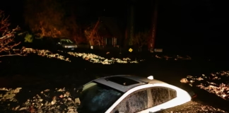
A powerful winter storm swept across large swaths of the Great Lakes and the Northeast from Friday evening into Saturday morning, blanketing communities in heavy snow and coating roads, trees and power lines with treacherous ice.
The fast-moving but disruptive system snarled air and ground travel during one of the busiest travel periods of the year, knocked out electricity for tens of thousands of customers, and served as a stark reminder that winter’s grip on much of the United States is far from over.
From major metropolitan airports to suburban neighborhoods and rural highways, the storm’s impacts were felt widely.
Airlines struggled to keep up as snow-covered runways and icy conditions forced delays and cancellations, while utility crews raced to restore power amid freezing temperatures. Although snowfall totals in some major cities came in slightly below forecasts, the timing of the storm coinciding with peak holiday travel, magnified its effects.
Travel chaos during a peak weekend
Air travel bore the brunt of the storm’s immediate disruption. According to flight tracking service FlightAware, more than 10,000 flights within, into, or out of the United States were delayed on Saturday alone, with more than 1,000 flights canceled outright. Airlines warned that delays and cancellations could ripple through the system for days, especially with another storm looming.
The problems did not end with Saturday. Early Sunday, as travelers attempted to continue or conclude their holiday journeys, FlightAware reported more than 600 additional delays and roughly 140 cancellations.
Transportation officials warned that Sunday was expected to be the busiest travel day of the season, raising concerns that even minor weather disruptions could cascade into significant backlogs.
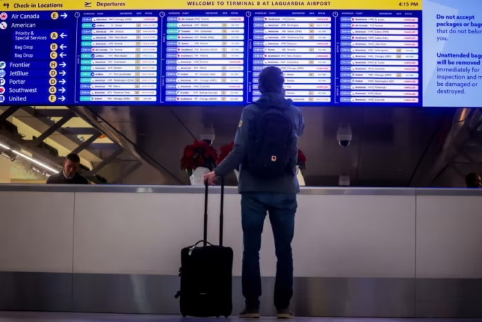
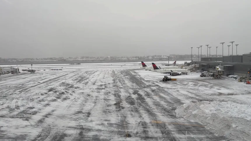
At New York City’s LaGuardia Airport, the effects of the storm were on full display. Flight information boards glowed with red cancellation notices, while outside, the airport’s aprons were blanketed in fresh snow. Aircraft sat idle, their outlines barely visible through the white haze, as crews worked to clear runways and taxiways.
Despite the inconvenience, many travelers appeared resigned to the disruptions. Felicia Reich, waiting for her delayed flight to Fort Lauderdale, Florida, said she had anticipated problems after monitoring the forecast. Bundled in a heavy winter coat and a bright orange-and-yellow knit hat, she struck a pragmatic tone.
“I was expecting it, but I was prepared,” Reich said, noting that she had built extra time into her travel plans.
Others were experiencing winter weather for the first time. Sarah Matthews, visiting the United States from Australia, said she and her travel companions had been excited to see snow until it complicated their departure.
“We were excited about the snow, because we’d never seen it,” Matthews said. “But for it to be snowing on our last day, and now we’re kind of delayed, that sucks a little bit. But we’ll make the most of it.”
At Newark Liberty International Airport in New Jersey, travelers moved briskly beneath holiday decorations, including a large Christmas tree that stood in sharp contrast to the gray, wintry conditions outside. John Hildebrandt, hoping to return to Las Vegas, said he was eager to escape the snow.
“I want to get out of the snow and get back to Vegas,” he told a local television station. “Hopefully there won’t be a delay.”
Snow, ice and power outages
Beyond airports, the storm’s mix of snow and ice caused widespread challenges for communities across the Great Lakes region.
In Michigan, where freezing rain and sleet accompanied snowfall, ice accumulation weighed heavily on trees and power lines. By Saturday morning, more than 30,000 homes and businesses across the state were without electricity, according to data from poweroutage.us.
Utility companies deployed repair crews throughout the region, but restoration efforts were slowed by icy roads and continued wintry precipitation. For residents, the power outages meant frigid indoor temperatures, spoiled food and heightened concerns about staying warm safely.
Local officials urged residents to avoid unnecessary travel, conserve heat and check on vulnerable neighbors, including the elderly and those with medical needs. Emergency management agencies also warned against using alternative heating sources such as grills or generators indoors, citing the risk of carbon monoxide poisoning.
New York prepares and cleans up
In New York City, municipal workers had spent days preparing for the storm. Crews pretreated roads with salt, staged snowplows throughout the five boroughs and coordinated with sanitation and transportation departments to ensure a rapid response once snow began to fall.
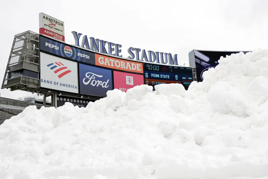
Those preparations paid off in part. Just over four inches of snow accumulated in Central Park, marking the city’s most significant snowfall since January 2022. While that total was roughly half of what the National Weather Service had predicted ahead of the storm, it was enough to slow traffic, blanket parks and rooftops, and require widespread cleanup efforts.
Early Saturday morning, snow blowers hummed and shovels scraped sidewalks across neighborhoods, from Manhattan to the outer boroughs. In Westchester County, north of the city, snowfall totals were higher, with some areas receiving up to six inches overnight. Residents cleared driveways and sidewalks as plow trucks made their rounds on residential streets.
Further east, Connecticut bore the brunt of the snowfall. Some parts of the state recorded more than eight inches of snow, making it one of the hardest-hit areas in the Northeast. In Hartwick, New York, snowfall exceeded 11 inches, turning rural roads into narrow, snow-packed corridors and prompting warnings from local authorities about hazardous driving conditions.
A brief lull before more winter weather
While the storm moved out of the Northeast by Saturday afternoon, forecasters warned that the respite would be short-lived. The National Weather Service said another winter storm system was already developing, poised to affect much of the Upper Midwest and Northeast beginning Sunday.
That next system is expected to bring a complex mix of snow, rain and strong winds, with blizzard conditions possible in parts of the Upper Midwest and Great Lakes. Forecasters warned that snowfall totals could reach a foot or more in some areas, accompanied by gusty winds that could reduce visibility and create dangerous travel conditions.
Behind the storm, an arctic air mass is forecast to plunge temperatures well below seasonal averages, increasing the risk of frostbite and placing additional strain on power systems and heating infrastructure. Residents were urged to prepare for bitter cold, ensure they had adequate heating fuel, and check emergency supplies.
Implications and Seasonal Impacts
Meteorologists noted that while winter storms of this magnitude are not unusual for the region, their impacts can be amplified by timing and geography. The combination of a busy travel weekend, lingering holiday schedules and back-to-back storm systems creates a compounding effect that challenges transportation networks and emergency services.
Airlines, already operating at high capacity during the holiday season, have limited flexibility to recover quickly from widespread disruptions. Even when weather conditions improve at major hubs, aircraft and crews may be out of position, leading to delays that persist for days.
Climate scientists also point out that warming global temperatures can contribute to more intense winter storms in certain regions. Warmer air holds more moisture, which can translate into heavier snowfall when temperatures are cold enough. At the same time, marginal temperatures can increase the likelihood of ice storms, which are often more damaging than snow alone.
For residents across the Great Lakes and Northeast, the weekend storm served as a reminder to remain vigilant throughout the winter months. Emergency officials emphasized the importance of monitoring forecasts, allowing extra travel time, and preparing homes and vehicles for severe weather.
As crews continue cleanup efforts and utilities work to restore power, attention is already turning to the next system on the horizon. With more snow, ice and bitter cold expected in the days ahead, much of the region remains firmly in winter’s grasp, bracing for what could be another challenging stretch of weather.

